Agent banking · GPS geo-tagging · Banking & FinTech
GPS Geo-Tagging in Agent Banking: Why It Matters and How USB GPS Receivers Work
By Raivens Editorial Team · · Updated · 6 min read
Key takeaways
- GPS geo-tagging lets banks verify that each agent-banking transaction happened at the agent's registered location.
- A USB GPS receiver reports its position as NMEA sentences through a virtual COM port that the banking software reads.
- Common field problems come from missing drivers, wrong COM settings, poor sky view or USB power saving.
- Treat geo-tags as one control alongside biometric authentication, device binding and transaction monitoring.
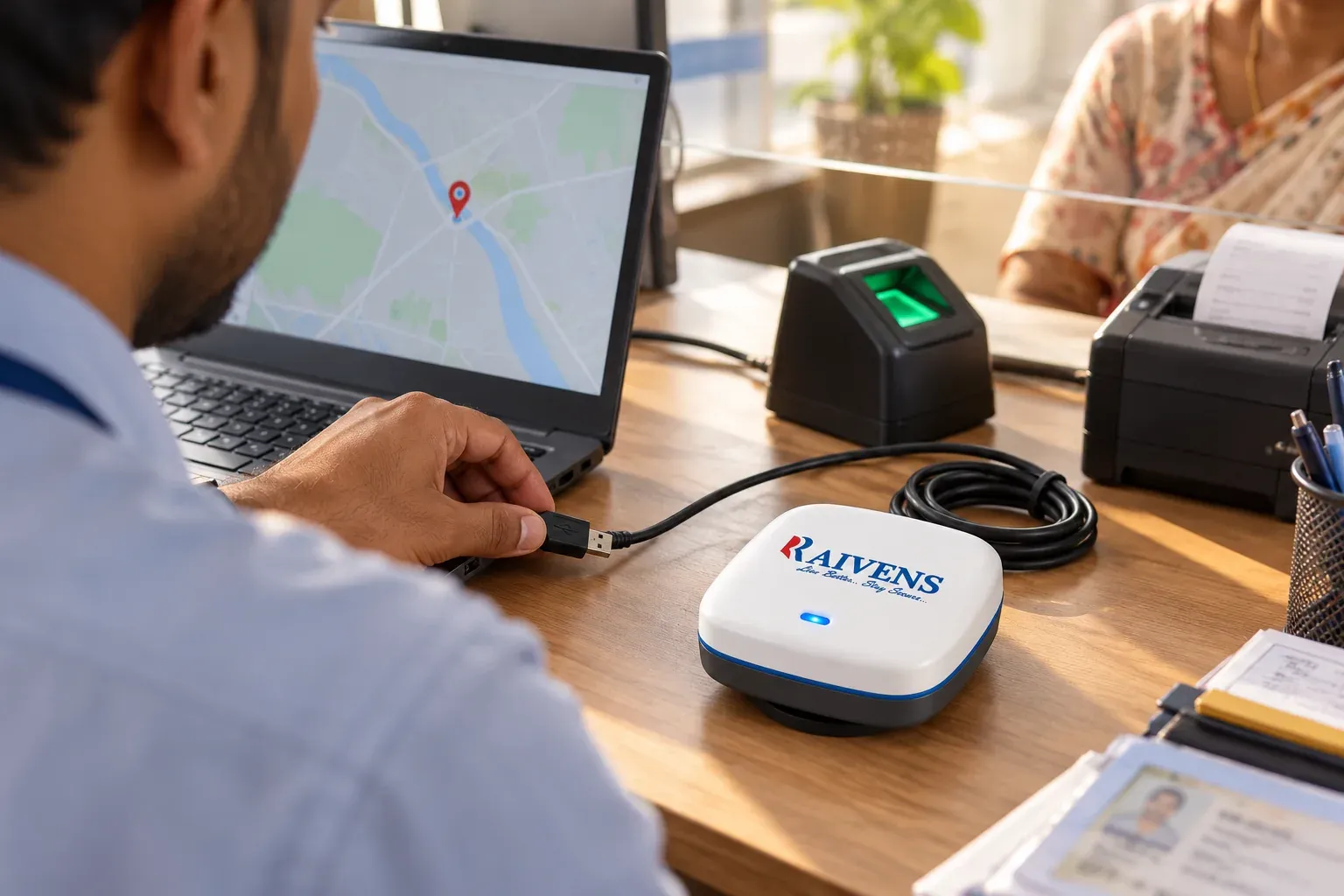
GPS geo-tagging gives every agent-banking transaction a verified location, so the bank can check it against the agent’s registered point and spot activity that happens where it should not. A USB GPS receiver plugged into the agent’s laptop or desktop computes its position from satellite signals and passes it to the banking software through a virtual serial (COM) port. The software then attaches latitude, longitude and time to each deposit, withdrawal or account service.
Why agent-banking transactions are geo-tagged
Banks, Business Correspondents (BCs) and agent-banking networks reach customers through shops, kiosks and field agents that the bank does not staff itself. Location data gives the bank independent evidence of how that network actually operates.
- Location control. Each agent point is registered for a specific place or service area. Geo-tags show whether transactions happen there.
- Fraud detection. Transactions far from the registered point, or several agents working from one spot, are early signs of shared credentials or unauthorized outlets.
- Audit and reporting. Banks often need to show auditors and supervisors where agent points operate and which areas they serve. Geo-tagged records turn declared locations into measured ones.
- Dispute resolution. When a customer disputes a transaction, location and time help reconstruct what happened.
- Network planning. Mapped transactions reveal underserved areas and places with more agents than demand.
How a USB GPS receiver feeds location to banking software
A USB GPS receiver is a compact satellite receiver with an antenna, a positioning chip and a USB interface. From sky to transaction record, the flow looks like this:
- Satellite fix. The receiver tracks navigation satellites and computes its position, typically to within a few meters under open sky.
- Standard output. It streams position data as NMEA 0183 sentences, plain-text lines such as GGA (position and fix quality) and RMC (position, date and time), usually once per second.
- Virtual COM port. A USB driver makes the receiver appear in Windows as a serial port, such as COM3.
- Application read. The banking client, or a small middleware service, opens that port at the configured baud rate, parses the sentences and checks fix quality.
- Tagging and validation. The client attaches coordinates and time to the transaction request. The bank’s server compares them with the registered location, often within a set radius called a geofence, and flags or blocks exceptions according to policy.
Why not rely on the computer’s own location? Wi-Fi and IP-based location can be coarse or easy to manipulate, and many agent computers have no location hardware at all. A dedicated receiver gives an independent satellite fix that the banking application reads directly.
Fix quality in brief
| Term | What it means | Why it matters |
|---|---|---|
| Cold start | First fix with no recent satellite data stored | Can take from under a minute to several minutes, longer indoors |
| Hot start | Fix after a short power-off, with recent data stored | Usually takes a few seconds |
| Satellites in use | Number of satellites used in the position | More satellites usually means a steadier position |
| HDOP | Horizontal dilution of precision, a geometry score | Lower values mean a more reliable position |
| Fix status | Valid (A) or void (V) in RMC sentences | Software should reject void fixes |
What the banking software should check
Good geo-tagging logic does more than copy coordinates into a field. It rejects void fixes, compares the fix time with the transaction time so a stale position cannot be reused, and sets minimum quality rules, such as a satellite count or HDOP limit. It stores the raw values with the transaction for audit. It also defines what happens when no fix is available: block the transaction, or allow it with a flag for review, according to the bank’s policy.
Deployment tips
- Install the driver first. Download the driver for your receiver version from the Raivens support page, install it, then plug in the receiver.
- Note the COM port. In Device Manager, find the receiver under Ports (COM and LPT) and enter the same port and baud rate in the banking software.
- Give it a view of the sky. Place the receiver near a window or doorway. A USB extension cable lets the computer stay where it is while the receiver sits at the window. Metal roofs, basements and thick concrete weaken signals.
- Allow time for the first fix. On first use, leave the receiver powered with a clear sky view for a few minutes before the first transaction.
- Keep the USB port awake. Disable USB selective suspend in the Windows power options, so the port does not sleep and drop the receiver.
- Record the reference location at onboarding. Capture the agent point’s coordinates once the fix is stable, and set a geofence radius that allows for indoor accuracy.
- Track devices by serial number. Link each receiver to the agent and computer it serves, so replacements and complaints are easy to trace.
Troubleshooting common problems
| Symptom | Likely cause | What to do |
|---|---|---|
| No COM port appears | Driver missing or faulty USB port | Install the driver from the support page, try another port, restart |
| COM port appears but no data | Wrong port or baud rate, or another program holds the port | Match port and baud rate; close other GPS or serial tools |
| Data arrives but no fix | Poor sky view or a cold start | Move the receiver to a window, use an extension cable, wait a few minutes |
| Position jumps or drifts | Signals reflecting off walls and metal | Move the receiver closer to open sky and away from metal surfaces |
| COM number keeps changing | Receiver plugged into different USB ports | Use the same port, or assign a fixed COM number in Device Manager |
| Stops working after sleep | USB power saving | Disable USB selective suspend and reconnect the receiver |
If a receiver still fails after these checks, test it on a second computer. A fault that follows the receiver points to the hardware, while one that stays with the computer points to its drivers, ports or settings. Record the serial number and the steps already tried before you contact support, which shortens the fix.
Go-live checklist
- Driver installed and receiver listed under Ports (COM and LPT)
- COM port and baud rate match the banking software
- Receiver placed with a clear view of the sky
- Valid, stable fix before the first transaction
- Reference coordinates and geofence radius recorded
- USB selective suspend disabled
- Serial number linked to the agent, computer and location
Where Raivens fits
RAIVENS USB GPS receivers, in versions 4.0, 5.0 and 8.0, give BC and agent points, bank kiosks and field laptops a verified location for every transaction. They are plug-and-play USB devices, with Windows drivers and an installation video on the Raivens support page. For complete agent points, Raivens also supplies BC point kits that combine GPS, biometric authentication, POS and printing, plus device lifecycle management that tracks every unit by serial number from factory test to returns. See hardware and software technologies for banks and BCs and the banking and fintech solutions overview. To equip or refresh receivers across an agent network, contact Raivens.
Frequently asked questions
Does a USB GPS receiver work indoors?
Often, but less reliably than outdoors. Satellite signals are weak and lose strength through roofs and concrete, so a receiver deep inside a building may take longer to get a fix or report a drifting position. Placing it near a window, or on a USB extension cable at the window, usually solves this. Raivens recommends checking the fix at every agent point during onboarding.
Can GPS location be faked?
Spoofing satellite signals is possible with specialized equipment, and software tools can fake location on some devices, so banks treat geo-tags as one control among several. Combining GPS with national ID-based biometric authentication, device binding, IP checks and transaction monitoring makes manipulation harder and easier to detect. Reading location from a dedicated receiver that the banking application controls also limits software tampering.
How accurate is USB GPS for geo-tagging?
Under open sky, a GPS receiver is typically accurate to within a few meters. Indoors, accuracy can drop to tens of meters because signals reflect off walls and metal. For agent banking, that is usually enough to confirm that a transaction happened at or near the registered point. Set geofence radii with this indoor margin in mind to avoid false alerts.
Where can I download drivers for RAIVENS USB GPS receivers?
Windows drivers for RAIVENS USB GPS receivers are on the Raivens support page, together with an installation video. Download the driver that matches your receiver version, install it before plugging in the receiver, and then confirm the COM port in Device Manager. If you are unsure which version you have, contact Raivens support before installing anything.